Areas in the Missouri Independence Mission
(If you have links to any web sites for these areas, please e-mail them
to me.)
State of Kansas Web Sites
Kansas Heritage
page
Kansas Areas in currently in the Mission
Andover, Kansas
The
City of Andover is a rapidly
growing community just east of Wichita, Kansas.
Great schools, access to shopping, recreation, employment opportunities, and
entertainment are just a few of the attractions to our community.
Andover, Butler County, Kansas 67002
The population of Andover is
approximately 5,200 (1998).
The approximate number of families is 1,499 (1990).
The amount of land area in Andover
is 9.376 sq. kilometers.
The amount of surface water is 0.016 sq kilometers.
The distance from Andover to Washington
DC is 1144 miles. The distance to the Kansas
state capital is 123 miles. (as the crow flies)
Andover is positioned 37.69 degrees
north of the equator and 97.13 degrees west of the prime meridian.
History
Andover was settled in 1880 by Ephrain Waggoner. It was originally named Cloud
City for a railroad man named Mr.
Cloud. The name was changed on June 7,
1880 to Andover.
The settling of Andover: 1880
The incorporation date of Andover:
February 4, 1957 with a
population of 166
Andover Kansas City Page
Andover.net Community Page
Arkansas
City, Kansas
Arkansas City Home Page
Arkansas City History
Atchison, Kansas
Atchison Kansas Page
Atchison
History
Augusta, Kansas
Butler
County 67010
Near
Wichita, KS
KU Education Agusta History
Burlington, Kansas
Burlington is located in Coffey
County southeast of Emporia
along US Highway 75 on the banks of the Neosho
River near John Redmond Reservoir. Burlington
is the Coffey County Seat.
The county
seat located near the center of the county on US Highway 75, Burlington is the home of County Critters, Victorian Memories and
Victorian Gallery. The central business district was recently improved
with new sidewalks, trees, and colonial street lights to create a downtown
plaza. The Cross Centre Shopping Center is located at the north edge
of the city.
66839
Welcome to
Coffey County
Coffey County
Cities
Coffeyville, Kansas
Concordia, Kansas
Derby, Kansas
Sedgwick
County 67037
Derby
is located in Sedgwick County
in south central Kansas between Wichita
and Winfield on Highway 15 near Mulvane.
Emporia, Kansas
Great Bend, Kansas
Great Bend is located in Barton County northwest of Hutchinson along US Highway
281 on the banks of the Arkansas River near Cheyenne
Bottoms and Fort Zarah. Great
Bend is the Barton County Seat.
Greatbend.com Lots
of information here
Great Bend Portal
 http://www.greatbendks.net/ City of Great Bend
page
http://www.greatbendks.net/ City of Great Bend
page
http://www.greatbend.org/index.asp
Chamber of Commerce
http://www.greatbend.com/visitor/index.htm
Visitor Information
http://www.cheyennebottoms.net/ Cheyenne Bottoms
http://www.usd428.org/ School District 428
http://www.bartonks.com/ Barton County Page
http://www.barton.cc.ks.us/ Barton County Community College Page
http://www.ckls.org/~gbpl/ Barton County Public Library Page
http://www.ckmc.org/ Central
Kansas Medical Center
Great
Bend Kansas Sites to See
Hays, Kansas
Hesston, Kansas
Hiawatha, Kansas
Howard, KS
Hutchinson, Kansas
Hutchinson is located in Reno
County (of which it is the county
seat) northwest of Wichita along US
Highway 50 on the banks of the Arkansas River near Sand
Hills State Park.
The population estimate for July 1,
1998 was 39,016, a decrease of 292 since 1990.
Kansas State Fair
Iola, Kansas
Junction
City, Kansas
Kansas
City, Kansas
Larned, Kansas
Lawrence, Kansas
Leavenworth, Kansas
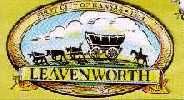
Leavenworth, Leavenworth County, Kansas
"First City of Kansas"
In 1966 Fort Leavenworth
was designated a Registered National Historic Landmark and a portion of the
fort is on the National Register of Historic Places.
The incorporation date of Leavenworth:
1854. Ft.
Leavenworth, just north
of Leavenworth, is the oldest Fort
west of the Mississippi River in continuous use.
The "Big House"
The Federal Penitentiary has been the home of many famous prisoners. Their most
famous prisoner was Robert Stroud, known in the movies as the "Bird Man of
Alcatraz". It's interesting to note that he did all of his bird work here,
serving 28 years in Leavenworth, before being transferred to Alcatraz. Nazi
prisoners were also kept here for a time. "Rocky" Graziano
got his start in boxing while incarcerated here.
Location
Leavenworth location: Just north
of Kansas City, Kansas
in the northeast portion of Leavenworth
County.
The population of Leavenworth is
approximately 39,431 (1996).
The approximate number of families is 12,568 1990.
The amount of land area in Leavenworth
is 58.816 sq. kilometers.
The amount of surface water is 0.051 sq kilometers.
The distance from Leavenworth to Washington
DC is 1016 miles. The distance to the Kansas
state capital is 47 miles. (as the crow flies)
Leavenworth is positioned 39.32
degrees north of the equator and 94.92 degrees west of the prime meridian.
Leavenworth elevation is 900
feet above sea level.
Ft. Leavenworth Museum
Leavenworth Development Page
Lenexa, Kansas
Lexington, Kansas
Lyons, Kansas
Manhattan, Kansas
McPherson, Kansas
Merriam, Kansas
Mission, Kansas
Mulvane, Kansas
Newton, Kansas
67114
Newton is located in Harvey
County (of which it is the county
seat) southeast of Salina along
Highway 15 near Hutchinson and
north of Wichita. Newton
is part of the Wichita, Kansas
metro area.
Olathe, Kansas
Ottawa, Kansas
Overland Park, Kansas
Paola, Kansas
Pratt, Kansas
Salina, Kansas
Shawnee Mission, Kansas
Topeka, Kansas
Topeka, Shawnee County, Kansas
To the Stars Through
Difficulty
The Kansas state capital.
The population of Topeka is
approximately 126,536 (1999).
The approximate number of families is 54,664 (1990).
The amount of land area in Topeka
is 142.87 sq. kilometers.
The amount of surface water is 2.52 sq kilometers.
The distance from Topeka to Washington
DC is 1059 miles. The distance to the Kansas
state capital is miles. (as the crow flies)
Topeka is positioned 39.03 degrees
north of the equator and 95.69 degrees west of the prime meridian.
The city tree is the Cottonwood.
The city bird is the Western Meadowlark.
Topeka location: near the
geographic center of the United States
in northeast Kansas.
Topeka City Page
Valley Center, Kansas
Wellington, Kansas
Wichita, Kansas
Winfield, Kansas
Missouri
Areas in currently in the Mission
Adrian, Missouri
Albany, Missouri
Archie, Missouri
Belton, MO
Blue Springs, Missouri
Butler, Missouri
Cameron, Missouri
Chillicothe, Missouri
Clinton, Missouri
Excelsior Springs, Missouri
Fleming Park, Missouri
Gladstone, Missouri
Grandview, Missouri
Harrisonville, Missouri
Independence, Missouri
Kansas City, Missouri
Lee
Summit, Missouri
Liberty, Missouri
Marysville, Missouri
Newmark, Missouri
North Kansas City, Missouri
Odessa, Missouri
Platte City, Missouri
Raytown (KC), Missouri
Richmond, MO
Riverside, Missouri
Sedalia, Missouri
Smithville, Missouri
St. Joseph, Missouri
Trenton, Missouri
Warrensburg, Missouri